The department has the honour of being the longest continuously running printing service in Australia, with connections to the early years of settlement in New South Wales. The first lithographic print was produced in 1828 in the Surveyor General’s Department, the precursor to today’s department, under the direction of Sir Thomas Mitchell. The first map was of St John in the Hundred of Parramatta, hand drawn on litho stone and reproduced for distribution in the colony.
The department was relocated in 1976 from Bridge Street in Sydney to Bathurst during the Wran government’s decentralisation plan. Those remaining employees are pleased that this occurred, and the department today is a prominent employer in Bathurst.
General manager of Graphic Services Operations, Stephen McRobert, took visitors on a whirlwind tour of the numerous facets of the department’s services, and wove some of its history into the presentations during the afternoon.
Click here to see pictures of the LIA’s tour at the Department of Lands and Information in Bathurst.
No longer just a printer and store for maps and land titles, DLI is now actively involved in the digitisation of New South Wales records. This includes the restoration, scanning and archival of about 300,000 plans, and over 550,000 small “flats” of titles from the department’s original archive in Bridge Street, which have to be shipped by department staff to Bathurst using strict security methods, recorded and sent back. Kakadu software, developed at the University of New South Wales, is used to help with batch scanning.
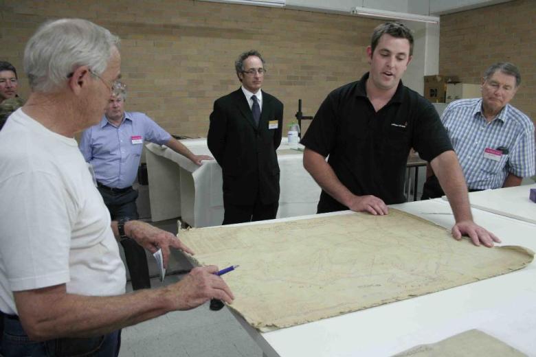
Conservation of the documents is a major part of the process. A private company, Preservation Australia, is helping the department and some of its staff to gain the required skills and undertake the work.
Another major project under way is the scanning and archival of the department’s many films of aerial photography of the state. Using Leica scanners, the films, over a million of them, are painstakingly rolled through the scanner and recorded, to preserve the images for posterity, and importantly, easier retrieval. Many of the older films are now deteriorating with age, and the pressure is on to record them before it is too late. The aerial photography has been updated with the installation of a digital camera to do the work in the plane, after many years of using film cameras to record the images.
The department also has a contract to record about 1,000 films from the Roads and Traffic Authority.
With all this archiving, the department has a major dilemma in storage capability. These archives hold enormous amounts of information — Stephen McRobert talks of pedabytes (millions of terabytes) of information that has to be archived and checked periodically for integrity.
Information held at the department is used for everything from land tax calculations to tracking sea rises from global warming. Aerial photography of the Murray Darling basin is helping the federal government in its efforts to arrest degradation. Information from the department has also helped state and federal governments to prosecute land clearing cases.
Visitors were also given a brief explanation of how the department has assembled maps until quite recently, with tracers painstakingly scratching outlines on numerous films, to be combined, then plated before printing.
Comment below to have your say on this story.
If you have a news story or tip-off, get in touch at editorial@sprinter.com.au.
Sign up to the Sprinter newsletter